DAMSCAPE
NIGER RIVER BASIN — WATER, SETTLEMENT & ECOLOGY
Architectural research into how dam infrastructure mediates settlement, agriculture and ecological systems across the Niger River Basin.
Navigating
the Basin.
The Niger River Basin spans eleven West African nations — a hydrological system whose seasonal fluctuations, navigable corridors and dam infrastructure determine the spatial conditions of millions of people. Damscape begins here: at the intersection of water, territory and settlement.
Systems
Under Pressure.
Mali's spatial crises — displacement, agricultural collapse, flooding, desertification — are not isolated events but layered systemic failures. The timeline maps these pressures against the built environment, tracing how environmental change reshapes settlement patterns and cultural continuity.
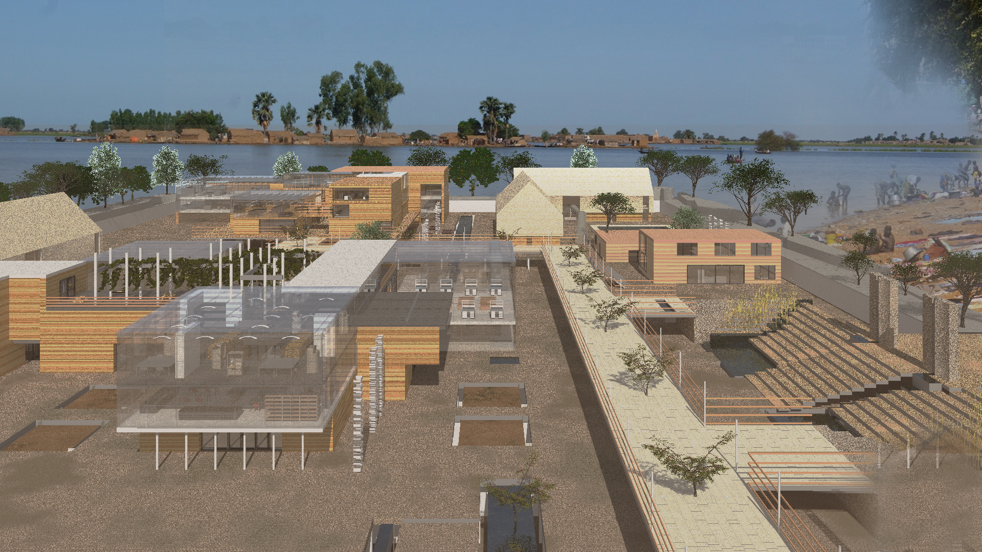
Designing
with Water.
The masterplan proposes a network of built programmes anchored to the dam landscape — an agricultural research campus, courtyard residential clusters and community learning infrastructure positioned in direct relationship with seasonal water cycles, flood plains and existing settlement patterns.
Earth,
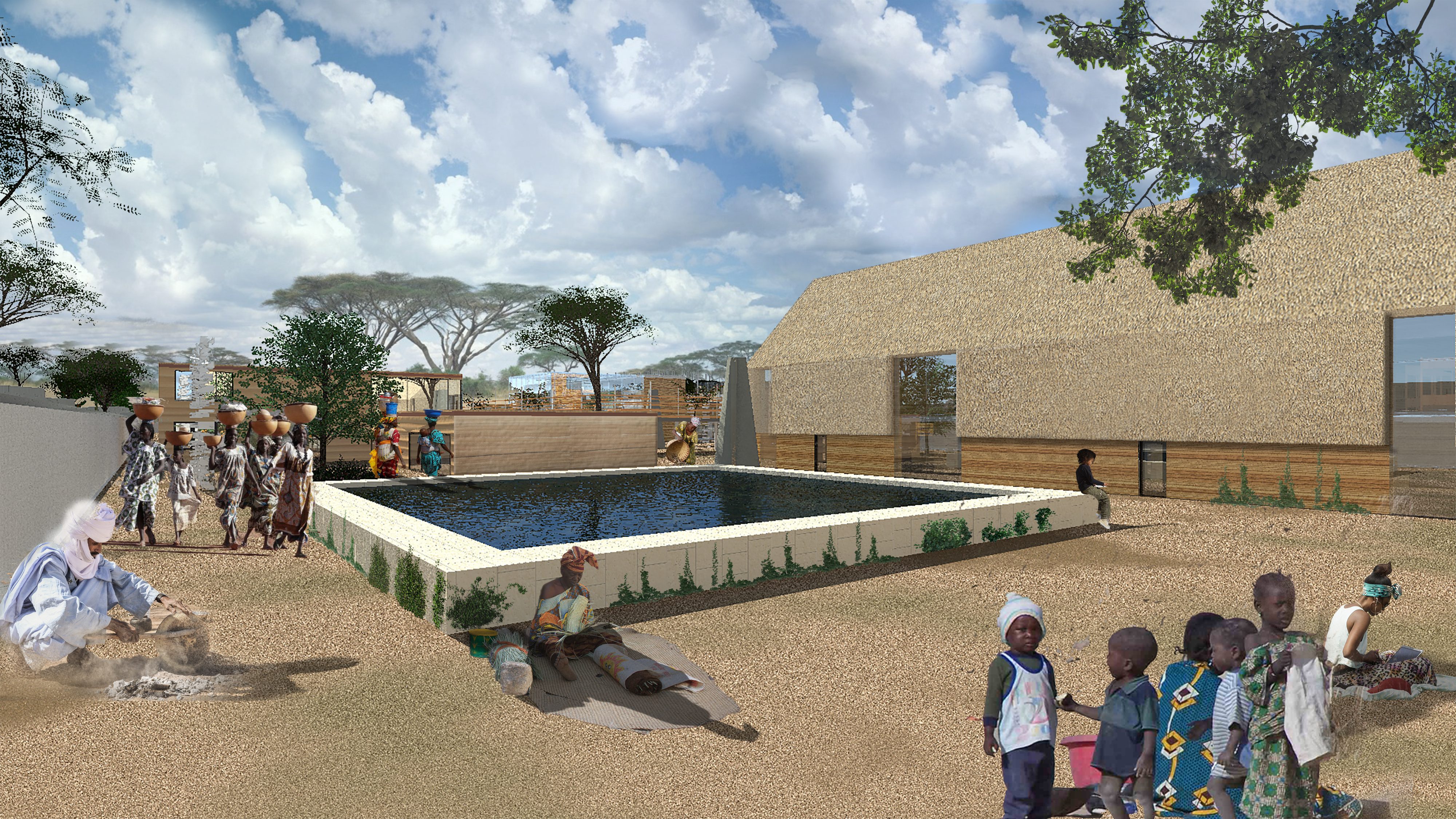
Courtyard, Light.
The project draws from the Tuareg rammed earth tradition and the spatial logic of the West African courtyard — typologies that manage thermal mass, shade, communal gathering and natural ventilation with precision. These are not nostalgic references but active structural intelligences adapted to a new programme.
Knowledge
Infrastructure.
The agricultural research lab and learning spaces form the core institutional programme — environments designed for skill transfer, ecological farming research and community education. Courtyard residential clusters provide housing for researchers, educators and local families within the same spatial network.
Courtyard
as Commons.
The courtyard residential typology creates a spatial commons — a shared threshold between private dwelling and collective life. At the scale of the settlement, these courtyards chain together into a network of shade, water, movement and gathering that defines Damscape's social infrastructure.
The
Intervention.
The primary spatial proposition — a built landscape that works with the periodic rhythms of the Niger River, positioning architecture as a mediating layer between flood, cultivation and habitation.
Damscape is an ongoing research project developed by Studio RDN-X investigating the spatial, ecological and social potential of dam landscapes across the Niger River Basin, West Africa.
Research drawings, masterplan proposals and architectural studies are protected intellectual property and represent speculative design research, not commissioned or built work.