DAMSCAPE
2.0
AMPHIBIOUS FUTURES — NIGER RIVER BASIN
Confronting the failure of extractive dam infrastructure. Proposing amphibious settlement, ecological production and environmental intelligence rooted in the living system of the Niger River Basin.
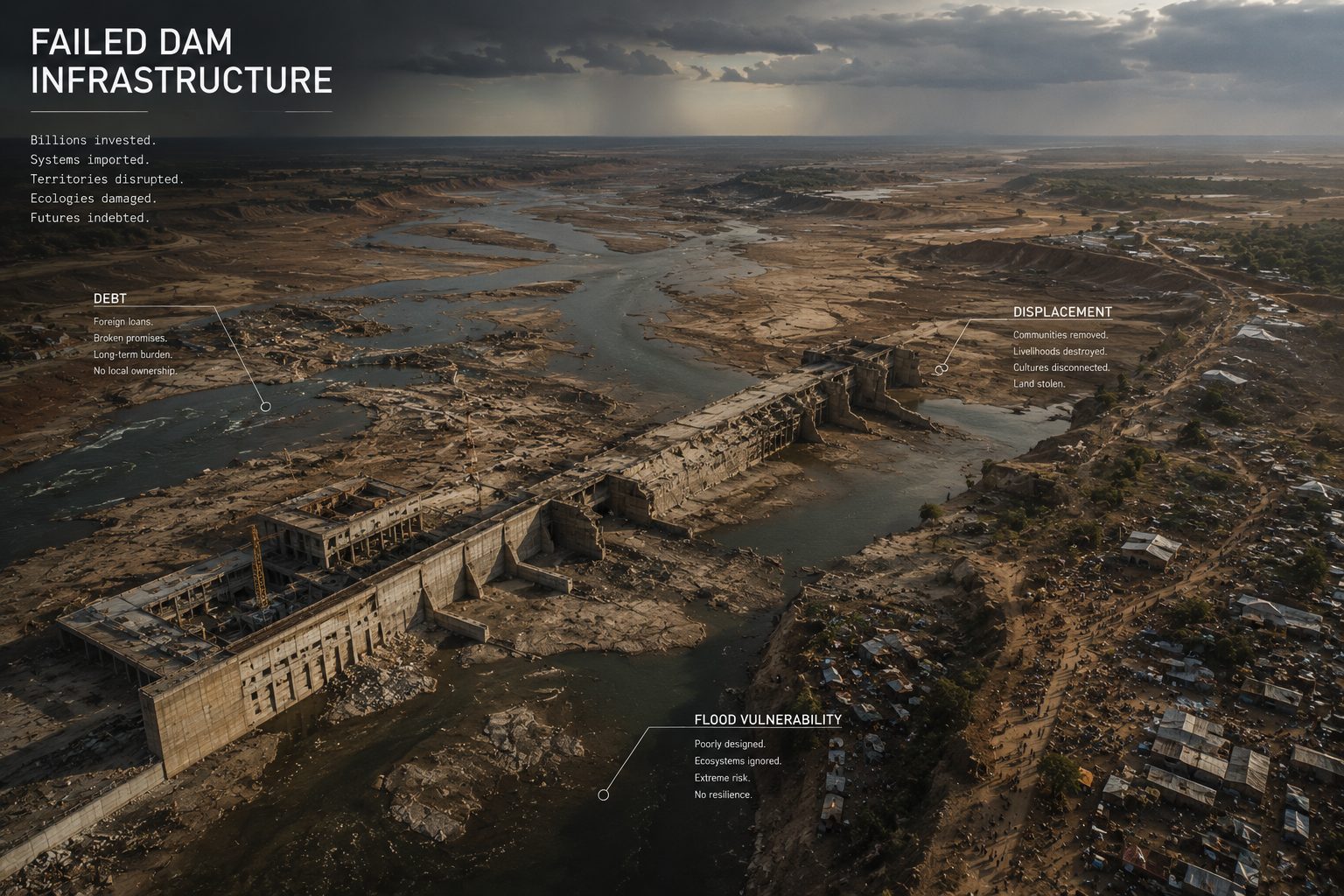
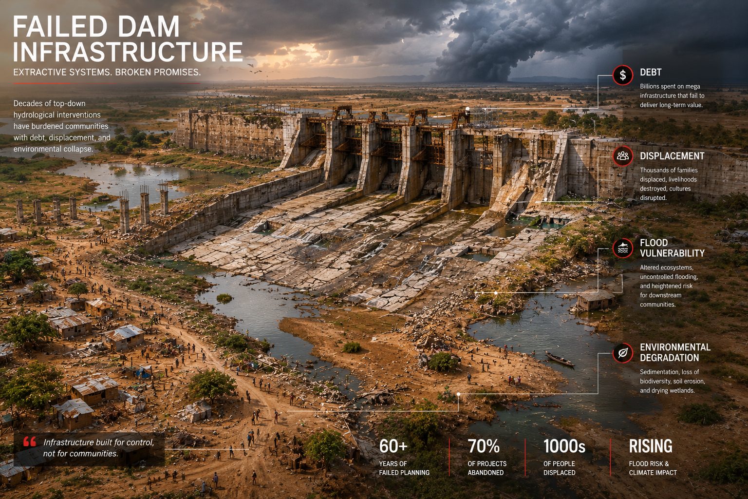
Failed
Infrastructure.
Decades of top-down hydrological interventions have burdened communities with debt, displacement and environmental collapse. 60+ years of failed planning. 70% of projects abandoned. Thousands displaced. The dam, as imported system, has consistently failed the territories it was meant to serve.
60+
YEARS OF FAILED PLANNING
70%
OF PROJECTS ABANDONED
1000s
OF PEOPLE DISPLACED
Rising
FLOOD RISK & CLIMATE IMPACT
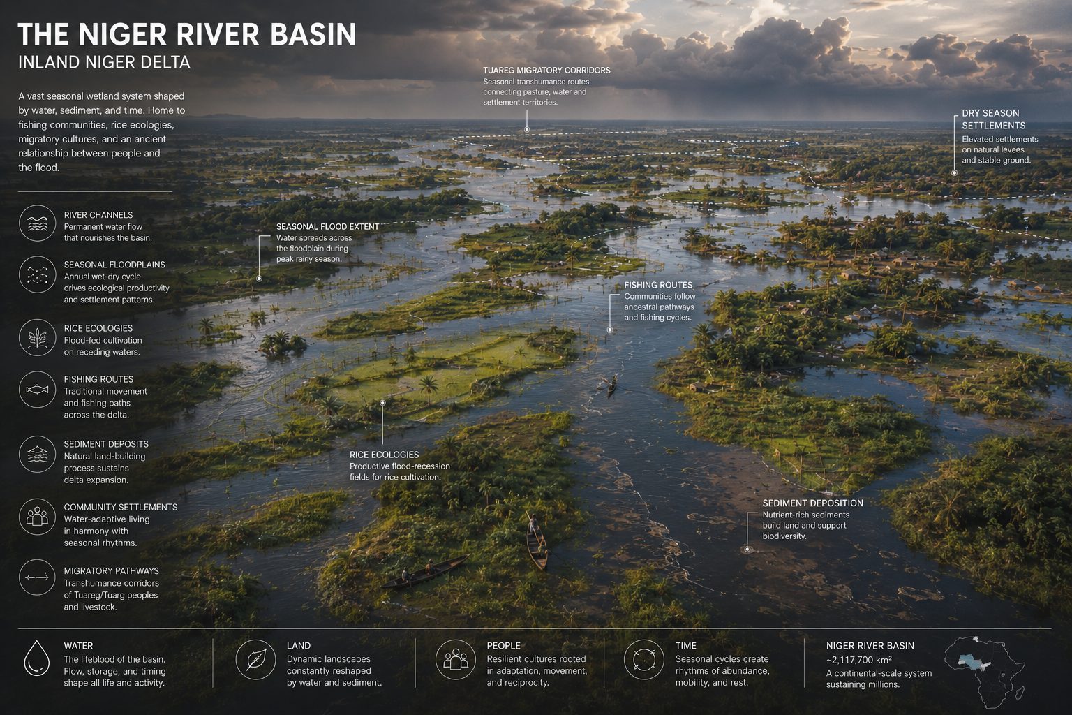
A Living
Hydrology.
The Inland Niger Delta is one of the most biodiverse and ecologically complex wetland systems on earth — a vast seasonal landscape shaped by water, sediment and time. Home to fishing communities, rice ecologies, migratory cultures and an ancient relationship between people and the flood. This is the system that extractive infrastructure has ignored.
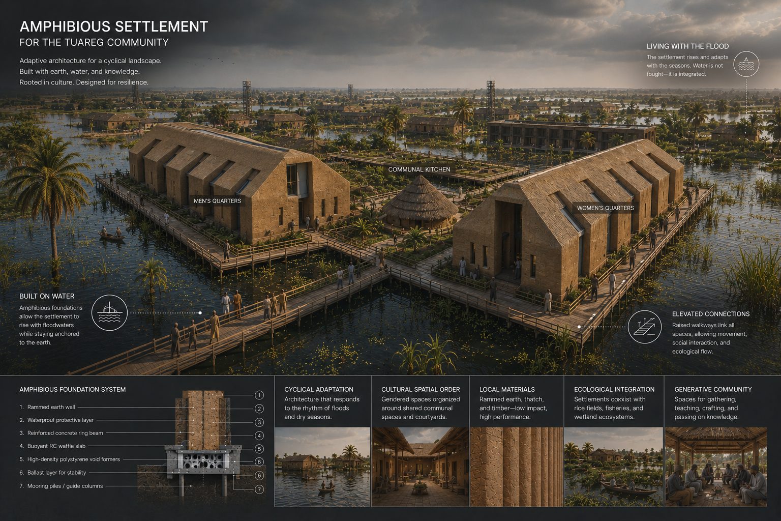
Built with
the Flood.
Adaptive architecture for a cyclical landscape — designed with earth, water and indigenous knowledge rather than against them. The Amphibious Settlement for the Tuareg community responds to seasonal flood rhythms through amphibious foundations, elevated connections and communal spatial order. Architecture that moves with the land rather than fighting it.
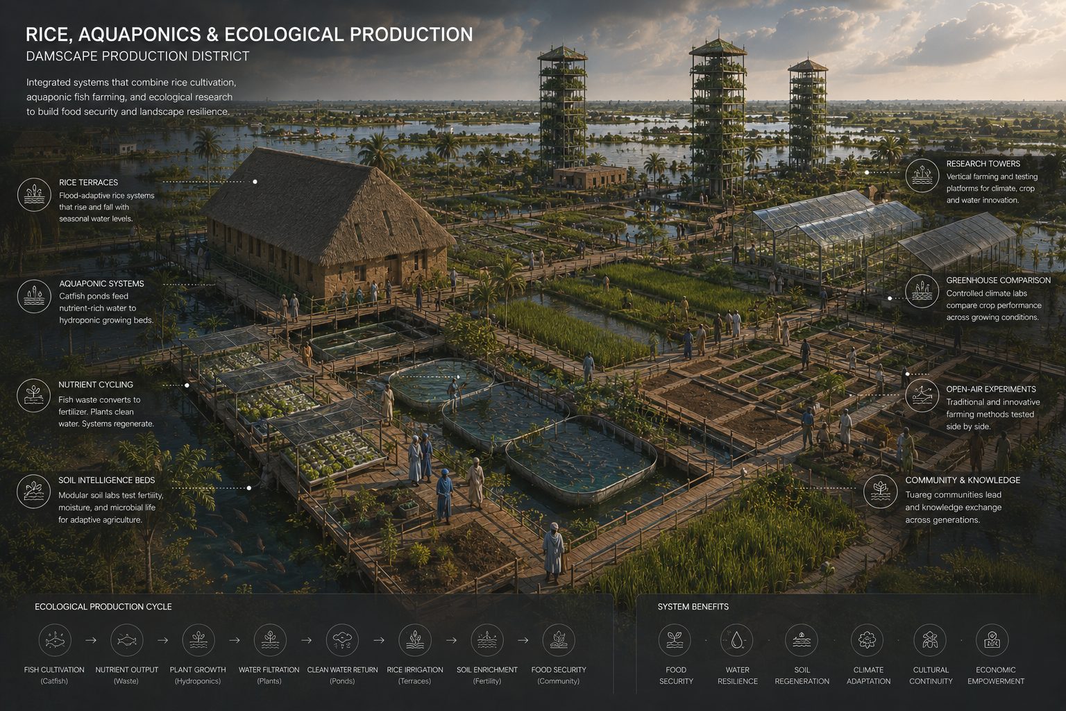
Rice, Water,
Knowledge.
Integrated systems that combine rice cultivation, aquaponic fish farming and ecological research to build food security and landscape resilience. Rice terraces rise and fall with seasonal water levels. Aquaponic systems convert nutrient-rich water into productive growing beds. Research towers test traditional and innovative farming methods side by side, passing knowledge across generations.
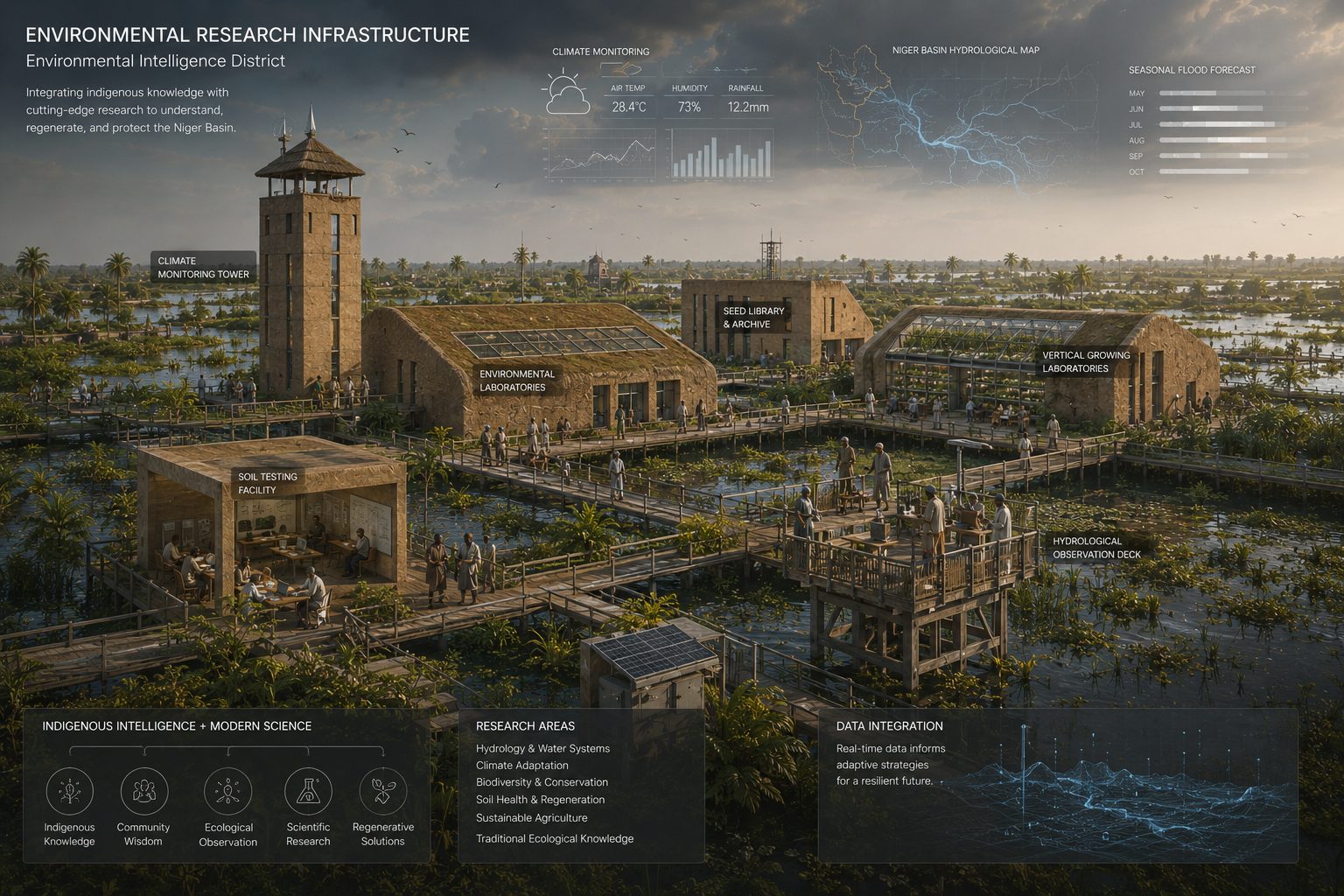
Indigenous
Intelligence.
The Environmental Intelligence District integrates indigenous ecological knowledge with cutting-edge research infrastructure — climate monitoring towers, environmental laboratories, seed libraries, vertical growing laboratories and a hydrological observation deck. A place to understand, regenerate and protect the Niger Basin through the combination of ancestral wisdom and contemporary science.
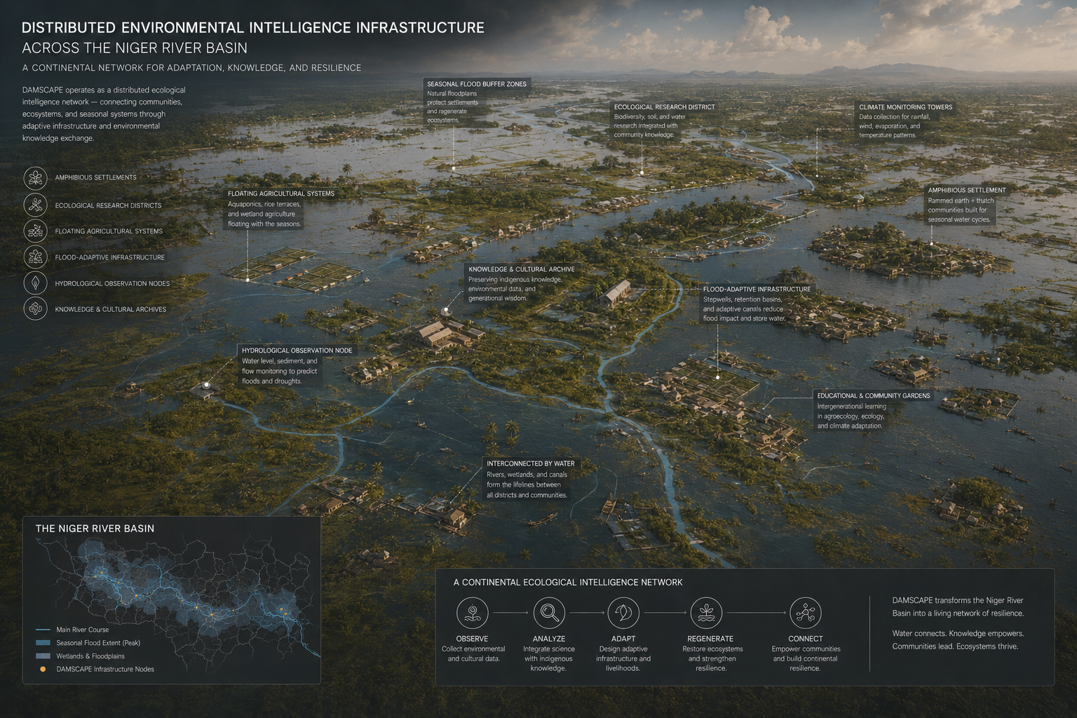
Connected
Intelligence.
DAMSCAPE operates as a distributed ecological intelligence network — connecting communities, ecosystems and seasonal systems through adaptive infrastructure and environmental knowledge exchange. Amphibious settlements, floating agricultural systems, hydrological observation nodes and knowledge archives chain together into a continental system of resilience across the Niger River Basin.
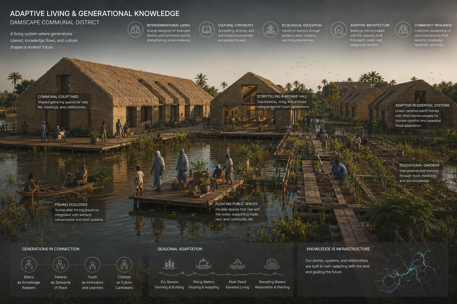
Living by
Generations.
A living system where generations coexist, knowledge flows and culture shapes a resilient future. The Damscape Communal District integrates communal courtyards, floating public spaces, fishing ecologies, educational gardens and adaptive rammed-earth residential systems — a settlement built to rise and fall with the seasonal rhythms of the Niger River Basin.
Damscape 2.0 is an ongoing research project by Studio RDN-X — a critical and propositional response to the legacy of extractive dam infrastructure across the Niger River Basin, proposing amphibious futures rooted in ecological intelligence, indigenous spatial practice and community resilience.
Research visualisations, spatial propositions and infrastructure studies are protected intellectual property and represent speculative design research, not commissioned or built work.